When we think of ocean pollution, we often picture “The Great Pacific Garbage Patch” or beaches strewn with plastic bottles. However, there is a far more insidious threat circulating in our own backyard. Microplastics—tiny fragments of plastic less than 5mm in diameter—are now a permanent fixture in British seas.
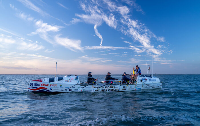
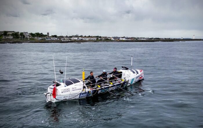
Through the GB Row Challenge, rowing teams are not just racing against each other; they are acting as a 2,000-mile floating sensor array. By collecting water samples around the entire perimeter of Great Britain, they have helped scientists create a “Microplastic Heatmap” that reveals exactly where our waters are most under pressure.
What Are Microplastics and Where Do They Come From?
Microplastics are generally categorised into two types. Primary microplastics are manufactured to be small, such as “nurdles” (plastic pellets used in industry) or microbeads in older cosmetics. Secondary microplastics are the result of larger items—like fishing nets, tyres, and polyester clothing—breaking down over time due to UV exposure and wave action.
Because they are so small, they are easily ingested by marine life, from tiny plankton to giant basking sharks. Once in the food chain, these plastics can carry toxic chemicals that eventually make their way into the seafood on our plates.
The GB Row Methodology: How the Map is Built
The strength of the GB Row data lies in its continuity. While most scientific studies take “snapshots” of one specific harbour or beach, the rowing teams sample the water constantly as they move.
The On-Board Filtration System
Every boat is equipped with a specialised pump system connected to a series of stainless-steel filters. As the crew rows, seawater is pulled through the system, and particles as small as 50 microns (thinner than a human hair) are trapped.
Laboratory Analysis
Once the race is over, these filters are taken to the University of Portsmouth. Researchers use a process called Micro-Raman Spectroscopy. This high-tech laser analysis allows scientists to identify not just how much plastic is in the water, but exactly what kind of plastic it is (e.g., polyethene from bags or nylon from fishing gear).
What the Heatmap Reveals: The UK’s Pollution “Hotspots”
The data collected over the last few years has provided some startling insights into the health of our coastal waters.
- The Urban Influence: Unsurprisingly, the highest concentrations of microplastics are found near major river estuaries, such as the Thames, the Mersey, and the Humber. These rivers act as “conveyor belts,” carrying urban runoff and treated sewage (which often contains synthetic clothing fibres) out to sea.
- The “Tidal Trap” of the South Coast: The English Channel shows consistently high levels of plastic, likely due to the massive volume of global shipping traffic and the way tides “trap” debris against the shoreline.
- Unexpected Findings in the North: Even in the remote waters of North-West Scotland, microplastics are present. This suggests that ocean currents are transporting pollution far away from its original source, meaning no part of the UK coast is truly “pristine.”
Key Findings from the 2024 and 2025 Data
Recent analysis has highlighted a few specific trends that have caught the attention of environmental policymakers:
- Fibre Dominance: A huge percentage of the plastic found around the UK consists of “microfibers” from synthetic textiles. Every time we wash a fleece or a polyester shirt, thousands of these fibres are flushed into the sea.
- Tyre Wear: “Dust” from car tyres—which contains plastic polymers—is a major contributor to coastal pollution, particularly in areas where large motorways run close to the shore.
- The Concentration Gap: In some areas, GB Row found microplastic concentrations that were double what was previously recorded by static research buoys. This proves that having a moving sensor (the rowing boat) provides a much more accurate picture of the problem.
Why This Data Matters for the Future
The Microplastic Heatmap isn’t just a map of shame; it’s a tool for change. By pinpointing where the pollution is worst, we can take targeted action:
- Informing Legislation: Data from GB Row has been shared with the UK government to support calls for better filtration in washing machines and stricter regulations on industrial plastic “nurdles.”
- Supporting Conservation: By knowing where plastic is most concentrated, we can better protect Marine Conservation Zones (MCZs) and ensure that fragile ecosystems aren’t being silently choked by plastic.
- Empowering the Public: Seeing the direct link between our daily habits (like driving or washing clothes) and the health of our favourite beaches is a powerful motivator for change.
Frequently Asked Questions
Can the rowers see the plastic they are catching?
Usually, no. While they might see the occasional “macro-plastic” like a floating bottle, the microplastics being sampled are often invisible to the naked eye. The filters look clean to the rowers, but under a microscope, they are often covered in thousands of tiny shards.
How does the plastic get from the river to the sea?
Rainwater washes plastic litter and tyre dust into storm drains and rivers. While sewage treatment plants catch some of this, many microfibers are too small to be filtered out, meaning they flow directly into the ocean.
Does the weather affect the sampling?
Yes. During heavy storms, the “mixing” of the water can pull plastic up from the seabed or wash more debris off the land. This is why the 2,000-mile journey is so valuable—it captures the water in all conditions.
The GB Row Challenge is proving that the road to a cleaner ocean begins with better data. As the 2026 teams prepare to set off, they are carrying the tools that will help us map, understand, and eventually eliminate the microplastic threat from our shores.
Share This Story, Choose Your Platform!
Recent Posts
National survey finds microplastic pollution around Britain’s coastline could be double than previously recorded
Microplastic pollution in the seas around Great Britain has been found at significantly higher concentrations than previously recorded by a joint project between the University of Portsmouth and GB Row Challenge. Data collected during the [...]
The Crown Estate joins GB Row Challenge as lead environmental data partner
The Crown Estate has partnered with GB Row Challenge, the endurance rowing race which collects vital scientific data on the health of UK coastal waters. GB Row Challenge, described as ‘the world’s toughest rowing race’, [...]